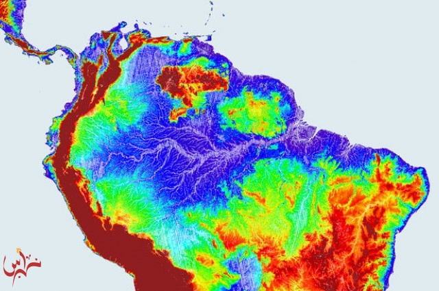
The Amazon once flowed in the opposite direction, from east to west. Reversing the direction of the Earth's largest river is no trivial thing, and geologists have pondered the cause for some time. In Earth and Planetary Science Letters The University of Sao Paulo's Dr Victor Sacek has demonstrated that nothing more than erosion is needed to explain this enormous shift.
With the mighty Andes at the western end of the continent it seems logical that South America's rivers flow east. While the Amazon discharges five times as much water as any other river on the planet, The Orinoco and the Rio de la Plata run the same way, each dwarfing any river in North America or Europe in the process.
However, until 10 million years ago, most of what is now the Amazon basin was drained by a river that flowed west into a giant lake that lay at the feet of the northern Andes. From there the water flowed north to the Caribbean Sea. Since the Isthmus of Panama had yet to form, this water was then swept west into the Pacific.
To tilt an entire continent seems such a vast endeavor that geologists had speculated changes in convection within the Earth's mantle, perhaps resulting from the break-up of Africa and South America, must have driven this.
Sacek, on the other hand, shows that the rise of the Andes as the South American plate rode over the Nazca Plate can explain the process on the appropriate timescale. Sacek included in his model the fact that as the mountains rose they intercepted more rain-bearing clouds, which in turn triggered more erosion.
At first the Andes rise produced a trough to the east, which became the paleolake into which the westward-flowing Amazon emptied. With time, however, this sinking slowed and erosion accelerated, replacing the lake with a series of wetlands known as the Pebas. The vast Pebas marshlands would have been an ecosystem like nothing we see today, but eventually sediment accumulation raised the region to the point where the rainfall in the area was pushed back the other way.
The model successfully matches the observation that sediment deposited at the Amazon's mouth has increased over the period of its eastward flow. At first, when the Amazon's sources were relatively flat, much of the sediment was dumped part way to its mouth, only being remobilized eons later.
Sacek admits however, that his model “Fails to fully reproduce the spacial and temporal evolution of the Pebas system as observed in geological data” and says further work is needed.


 كسوة الكعبة المشرفة
 الفيصل يضخ المياه العذبة ويؤسس للجامعات في محافظات المنطقة / نبراس - إنتصار عبدالله
 تصحيح أوضاع 249 ألف برماوي خلال عامين أطلقها الأمير خالد الفيصل عام 1434هـ


